
Marine Seismic Refraction (MSR)

Seismic refraction is an active geophysical method based on the principle governed by Snell’s Law of refraction. This permits the reconstruction of geometries and thicknesses of the subsurface, depths of substrata (within the limits of seismic source penetration), eventual lateral discontinuities, and seismic velocities of material, via the study of elastic waves generated on the surface.

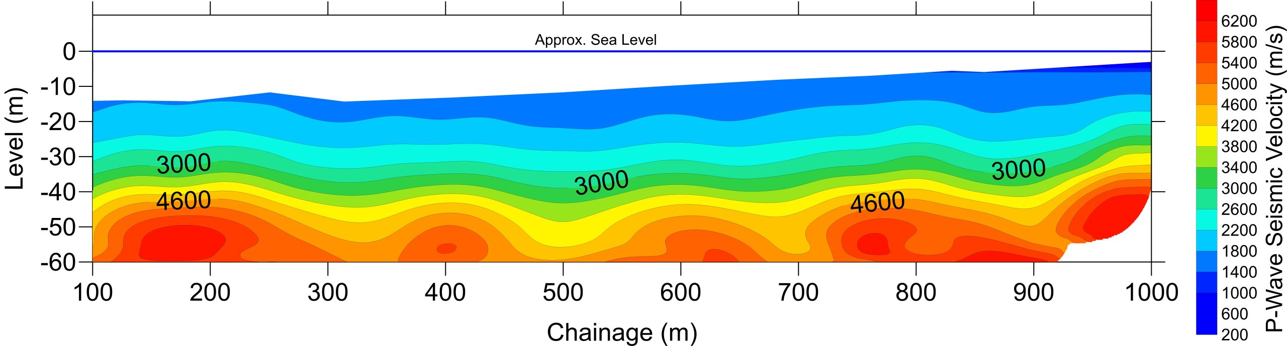
Seismic waves (P-waves) energy is generated using an acoustic source at predetermined locations (S). The travel times of acoustic energy that has been critically refracted at horizons of interest (L1) is recorded at predetermined receiver locations (R1, R2, etc.). The recorded travel time information is used to generate a velocity–structure profile of the subsurface along the length of the refraction profile.

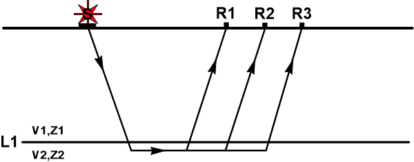
Modified from “Introduction to Geotechnical Geophysics – N. Anderson and N. Croxton, Circular – Number E-C130, October 2008”.

There are two main Marine Seismic Refraction (MSR) systems, Underway and Static.

Underway:

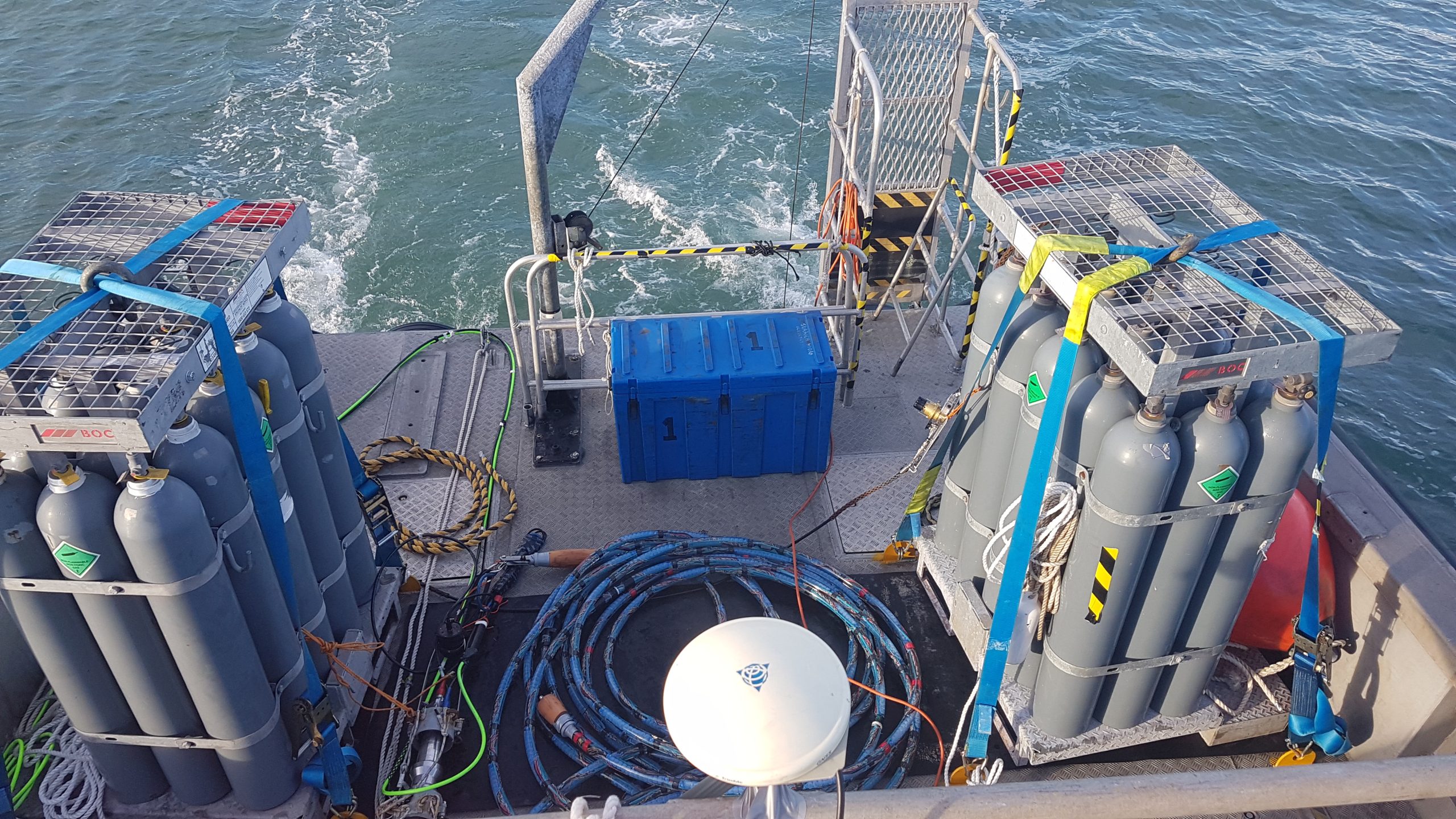
MSR has been developed to quantify and qualify seismic P-waves velocities distribution in challenging terrain/environment, the sub-seabed.

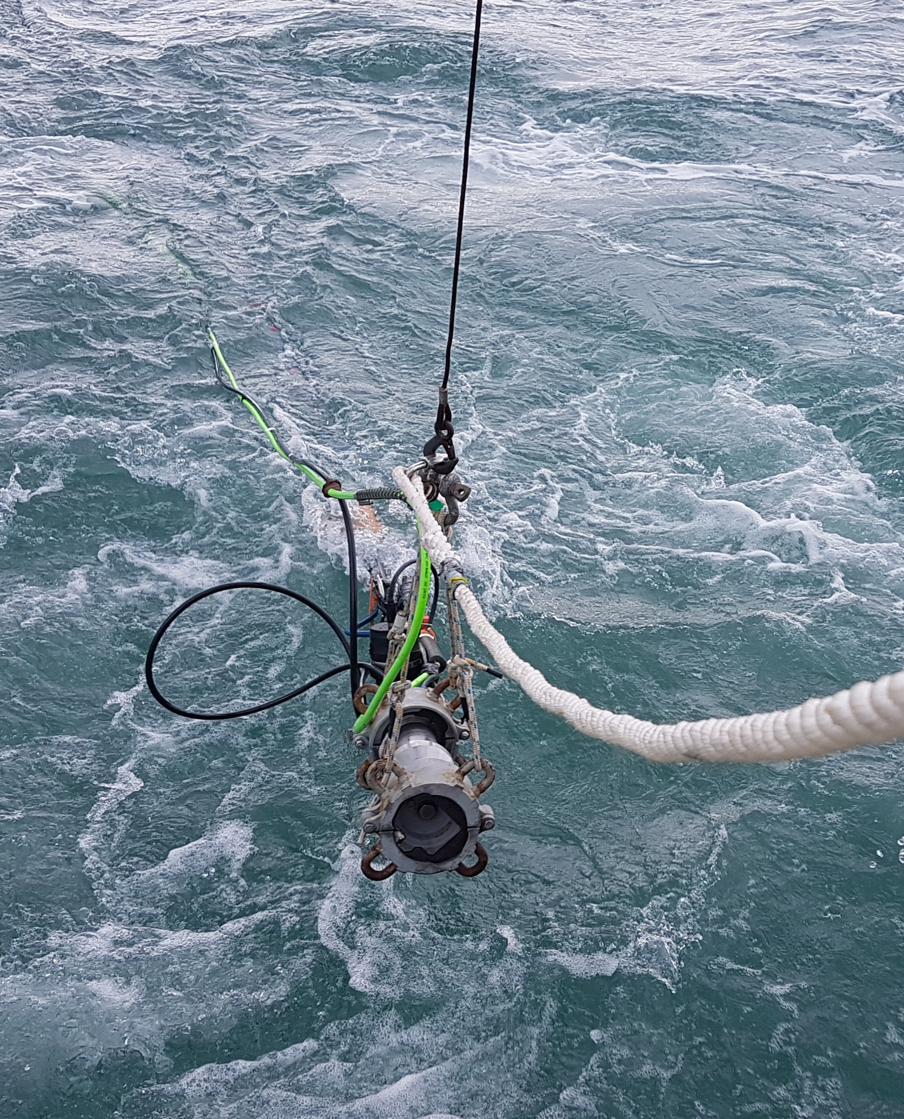
A seismic streamer (receivers) with various spacing and number of hydrophones is secured and towed behind a vessel in line with a seismic source, which consist of various levels of power (pressure chamber size) air-pressure-gun. The streamer and seismic source, which move in sync, are connected to a seismograph and position/navigational system on board vessel.

The system can be surface, mid, or bottom towed.

Static:

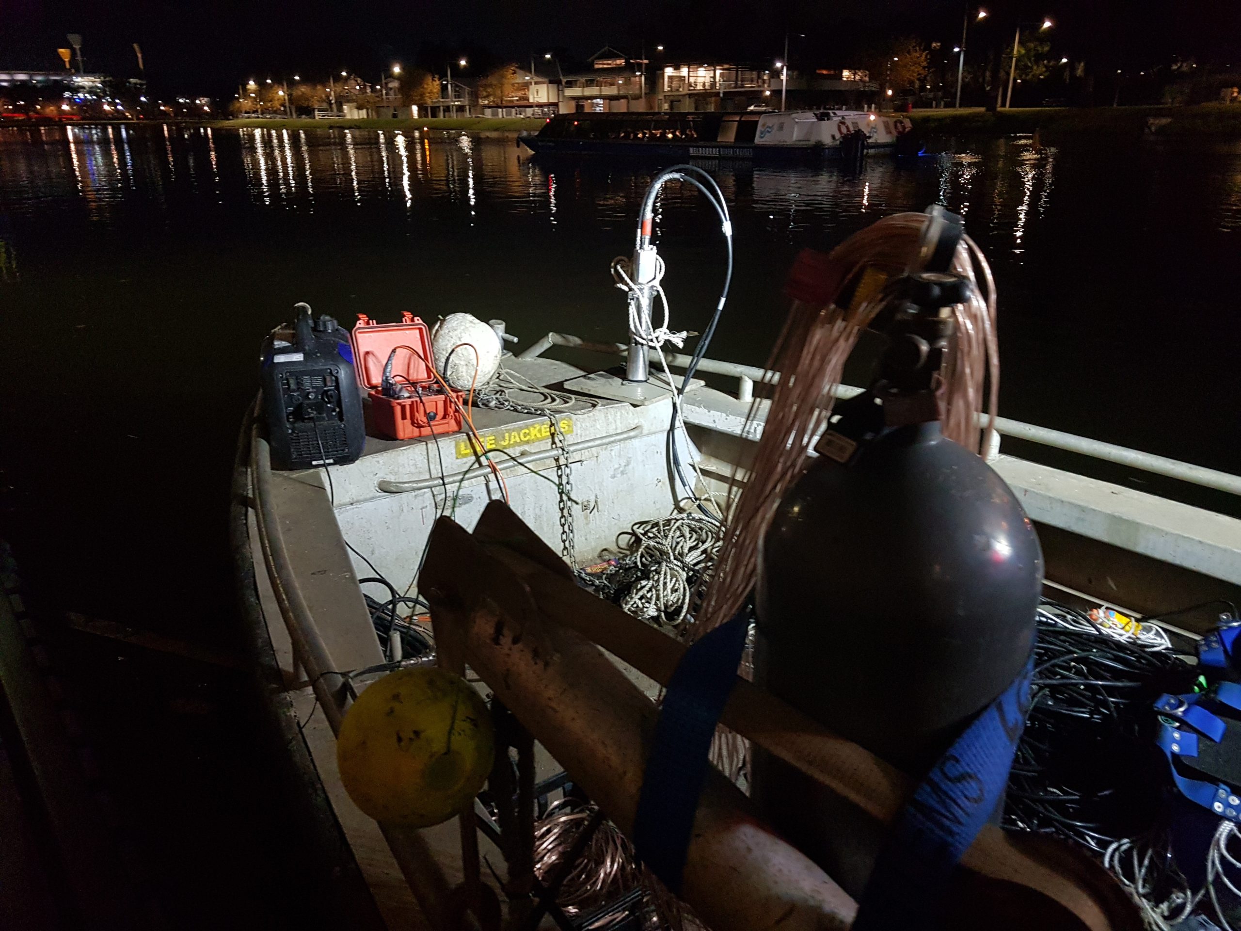
This system is normally used for river crossing, very shallow water bodies that preclude normal navigation or short investigation requiring high resolution.

The system is a combination/adaptation of SRT and MSR. Basically, the system and geometries are as per SRT, but with hydrophones instead of geophones.

Example result of an Underway MSR

What are the most common uses of Marine Seismic Refraction?

Sediment thickness
Mapping
Dredgeability
Rock layering
Soil profile
Rock and soil characterisation

Marine Seismic Refraction FAQs

What is a marine seismic refraction testing?

Marine seismic refraction (MSR) is carried out for the sole purpose of knowing the P-waves seismic velocities of materials in the sub-seabed.

In open waters, this is achieved by towing an array of detectors (i.e., hydrophones) on the seabed, mid-water column or sea surface, at known distances, and seismic waves are generated via air pressure gun at a fixed point between vessel and start of array. Both hydrophones and seismic energy source are connected to a seismograph, which is basically an extremely sophisticated chronometer. Once the seismic waves are generated, the seismograph starts counting the time the waves take to travel through the medium, refract, and arrive to the hydrophones. By knowing the time and the distance travelled by the seismic waves we can calculate the velocities. Velocity = Distance / Time…simple.

How much does a marine seismic refraction survey cost?

The costs for a MSR survey are determined by the size and complexity of the site, and the project requirements. Therefore, it is difficult, and misleading, to provide an exact dollar value without knowing the particulars. A very indicative cost for the fieldwork component can vary from $3,500 to $6,500 per day. This excludes mobilisation and demobilisation, which can vary by 10s of thousands of dollars, Australia is big! Also, it excludes processing and reporting, which depends on the amount of data acquired.

Reach Out and Let’s Discuss Your Project

No matter how simple or complex is your project, we can assist in many ways…a technical explanation? A practical field implementation? A budget discussion? Or a full project planning and execution? Just ask away.